
Gideon Weissman
Former Policy Analyst, Frontier Group
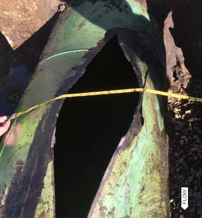
The Keystone Pipeline has already suffered multiple spills, including a 210,000-gallon spill in November 2017. A geographic analysis of the pipeline finds that it likely threatens thousands of waterways along much of its route.
The following is a lightly edited excerpt from Accidents Waiting to Happen: Toxic Threats to Our Rivers, Lakes, and Streams. Access the full report here.
For most crude oil pipelines, publicly available geographic data is too low-resolution to perform an accurate analysis. For the Keystone Pipeline, however, a non-governmental effort called the Keystone Mapping Project has created a more detailed map using information from a variety of sources (for example, environmental impact statements).
The Keystone Pipeline has already suffered multiple spills, including a 210,000-gallon spill in November 2017. A geographic analysis of the pipeline finds that it likely threatens thousands of waterways along much of its route. The pipeline makes 2,370 waterway crossings, more than 300 crossings in each of the six states it passes through. The pipeline also passes through 455 miles of FEMA flood zones, 11 percent of the total length of the pipeline. Much of the pipeline runs through areas that have not been mapped by FEMA, so this estimate is likely conservative.
For 1.3 miles of its route, the Keystone pipeline runs through a flood zone by the Sabine River in northeast Texas. According to a report by Public Citizen, “[d]ozens of anomalies, including dents and welds” were found along a stretch of the pipeline in the area north of the Sabine River.
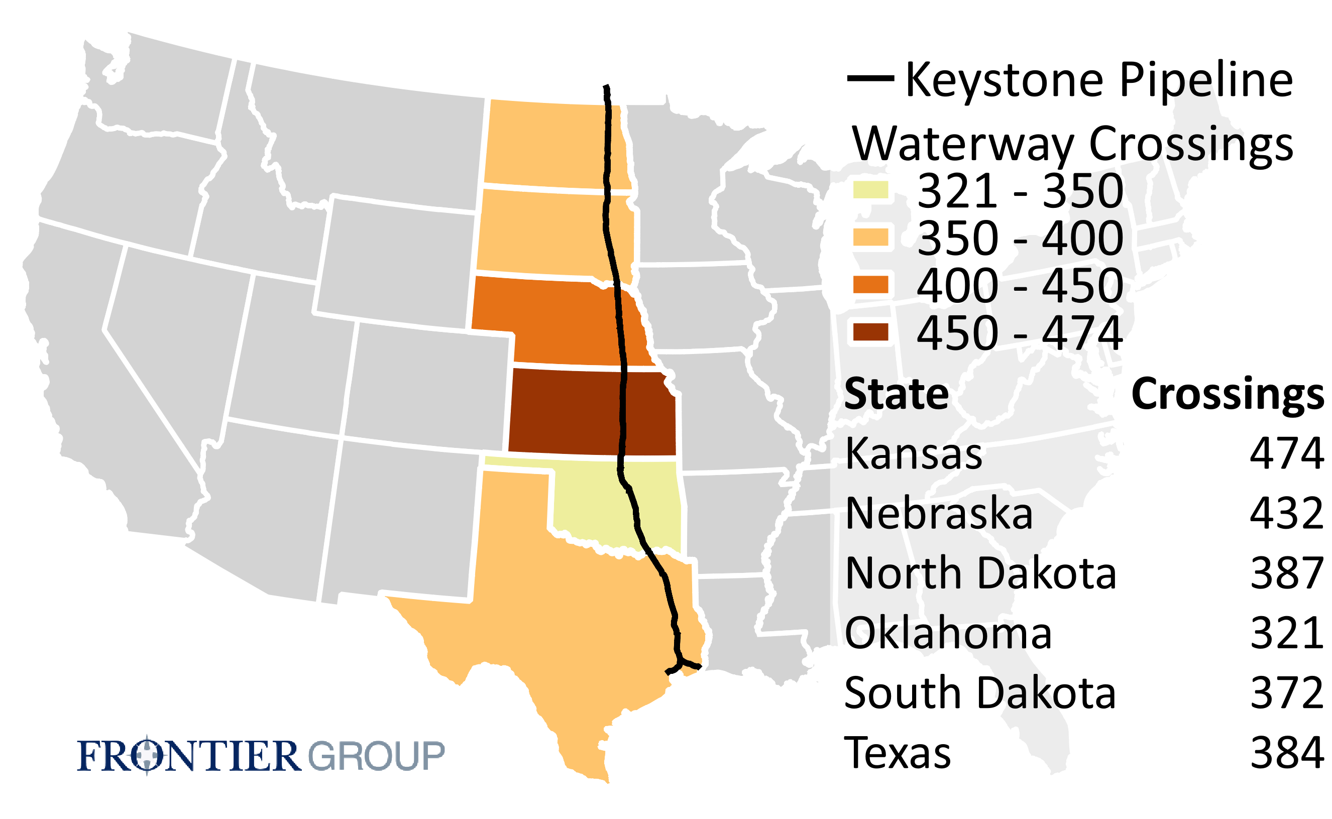
The Keystone Pipeline makes 2,370 waterway crossings in the U.S.
Top image: This rupture in the Keystone Pipeline near Amherst, South Dakota, led to the spill of approximately 5,000 barrels of oil. Credit: National Transportation Safety Board
Former Policy Analyst, Frontier Group