
Jeff Inglis
Policy Analyst
When the Clean Water Act is applied to American waterways, good things can happen. Our recent report, Waterways Restored: The Clean Water Act's Impact on 15 American Rivers, Lakes and Bays, highlights waterways where the Clean Water Act's protections and improvement provisions have had positive effects. Polluted waterways have been cleaned up, pristine waterways have been preserved, and threatened waterways have been protected. All waterways deserve these opportunities. In this blog series, we'll showcase individual case studies from the report. The third installment is California's Big Sur region and Monterey Bay.
When the Clean Water Act is applied to American waterways, good things can happen. Our recent report, Waterways Restored: The Clean Water Act’s Impact on 15 American Rivers, Lakes and Bays, highlights waterways where the Clean Water Act’s protections and improvement provisions have had positive effects. Polluted waterways have been cleaned up, pristine waterways have been preserved, and threatened waterways have been protected. All waterways deserve these opportunities.
In this blog series, we’ll showcase individual case studies from the report. The third installment is California’s Big Sur region and Monterey Bay.
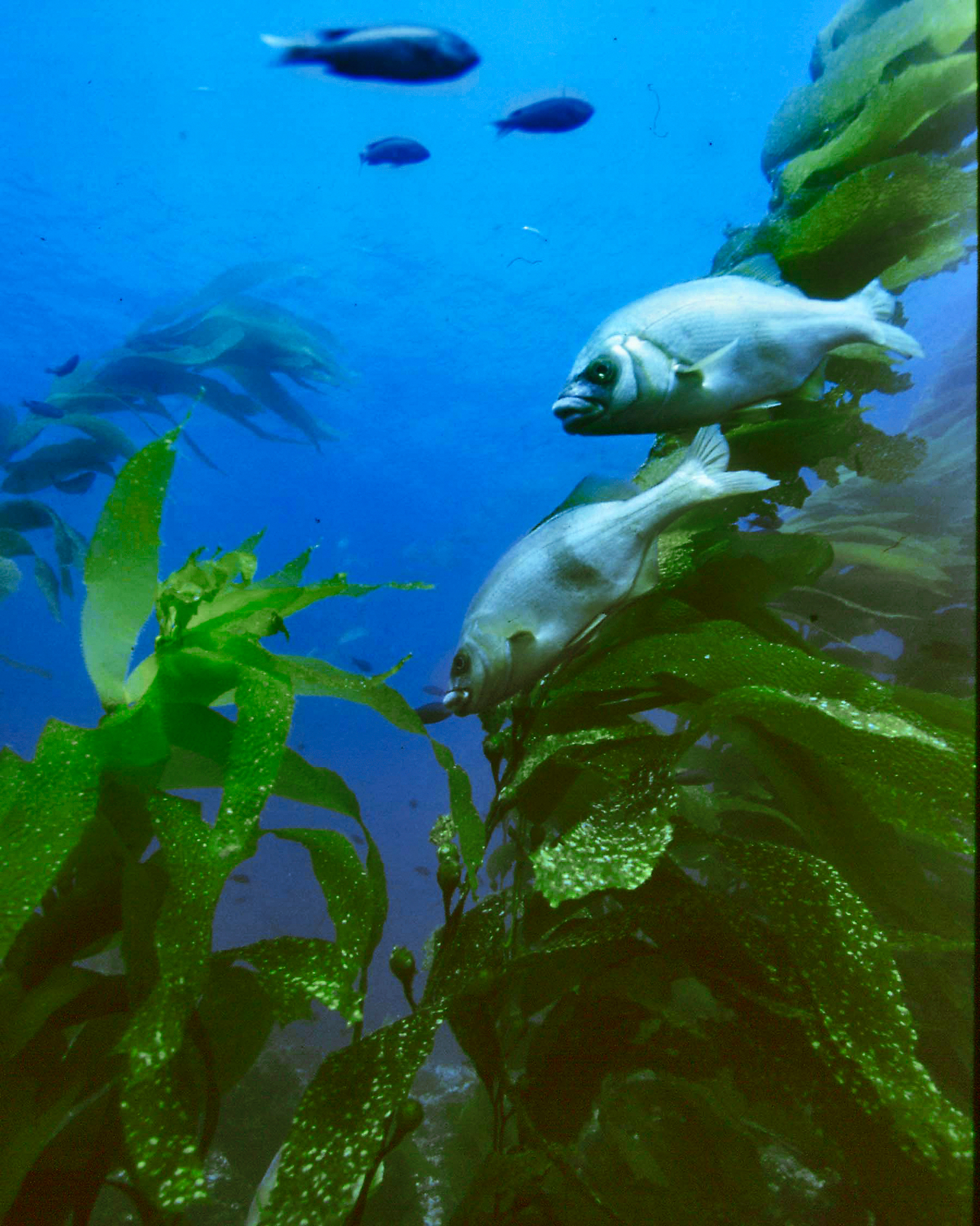
The world-renowned kelp forests of the Monterey Bay National Marine Sanctuary are better protected because of financing provided under the Clean Water Act for the purchase of property that preserves headwaters of several of the bay’s tributaries. Photo by National Oceanic and Atmospheric Administration.
In 2001, Palo Corona Ranch, a 10,000-acre parcel of land in the heart of California’s Big Sur region, went up for sale.[i] The highly valuable property, very attractive to developers, starts near the mouth of the Carmel River and stretches seven miles inland, encompassing one of the river’s tributaries and the headwaters of several local streams. All watersheds in the area drain to the Monterey Bay National Marine Sanctuary, a federally protected area off the California coast known as the “Serengeti of the Sea” for its remarkable abundance of wildlife.[ii]
Despite its environmental value, developers eyed the ranch for its profit-making potential. Local environmental groups, having recently seen a similar tract be subdivided for development, feared that residential or commercial development of the land would pollute waterways both on and downstream of the property through increased sedimentation and stormwater runoff.[iii] Runoff typically carries a variety of pollutants – from oil and grease to metals – into waterways where they can poison aquatic life and degrade water quality.
To protect local rivers and the Marine Sanctuary from this new pollution threat, concerned citizens and environmental groups had to obtain the land before developers did. A provision of the Clean Water Act helped make this possible: The Clean Water State Revolving Fund (CWSRF) helps states maintain loan funds to provide financing for projects including wastewater treatment, estuary protection activities and efforts to reduce or eliminate pollution from nonpoint sources. The latter can include activities such as watershed management, runoff control and habitat and wetlands protection.[iv] In some cases, that means acquiring environmentally valuable or sensitive land, such as Palo Corona Ranch, to avoid development and pollution in the first place.
In 2004, the Nature Conservancy used a $9 million CWSRF loan to finalize the acquisition of the ranch.[v] The purchase protected Palo Corona’s waterways – and waterways downstream – by establishing a buffer around the area’s source waters and eliminating the threat of runoff pollution that results from laying pavement and building other impervious surfaces.[vi]
Over the course of the next seven years, the Conservancy transferred the land to the California State Department of Fish and Game and the Monterey Peninsula Park District to begin the transition of the ranch into parkland. Today, the northern half of the former ranch comprises the new Palo Corona Regional Park, open to the public for hiking; the southern half of the parcel was added to the adjacent Joshua Creek Ecological Preserve.[vii] The “gateway to Big Sur,” the land now provides a safe home for coastal trout and the red-legged frog and tiger salamander in its perennial creeks, which are now likely to remain protected from runoff pollution for years to come.[viii]
[i] The Nature Conservancy, Case Study: Partnering to Build Future Capacity, Big Sur, California, n.d.
[ii] National Oceanic and Atmospheric Administration, Monterey Bay National Marine Sanctuary Overview, accessed at www.montereybay.noaa.gov, 11 September 2014.
[iii] California State Water Resources Control Board, Notes of the Board Meeting Session – Division of Financial Assistance, 15 October 2003.
[iv] U.S. Environmental Protection Agency, How the CWSRF Program Works, accessed at www.water.epa.gov/grants_funding/cwsrf, 10 September 2014.
[v] U.S. Environmental Protection Agency, Green Infrastructure Approaches to Managing Wet Weather with Clean Water State Revolving Funds (fact sheet), July 2008; Monterey Peninsula Regional Park District, Palo Corona Regional Park, accessed at www.mprpd.org, 10 September 2014. Note: The Nature Conservancy and the Big Sur Land Trust initially bought the ranch in 2002 using short-term financing in response to imminent development threats. The 2004 CWSRF loan allowed the Conservancy to meet obligations on its short-time financing and continue to hold the property, per California State Water Resources Control Board, Notes of the Board Meeting Session – Division of Financial Assistance, 15 October 2003.
[vi] See note iii.
[vii] Monterey Peninsula Regional Park District, Palo Corona Regional Park, accessed at www.mprpd.org, 10 September 2014; The Nature Conservancy in California, 2012 Annual Report, 2012, 25.
[viii] Monterey Peninsula Regional Park District, Palo Corona Regional Park, accessed at www.mprpd.org, 10 September 2014.
Policy Analyst